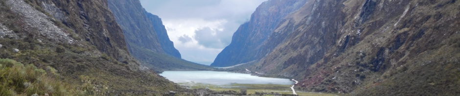
Bryce Canyon National Park was really weird, and I mean that in the best way possible. You may agree as you drive towards the park.
 Remember, remember, I traveled in November, and hey! We got blasted by a snowstorm. Bryce town has an elevation of 8,000 feet so it was cooold. On the bright side, the snow made everything look amazing and hey, the trails were almost all ours. We made our short journey from Zion to Bryce, just under an hour and a half, early in the morning. Bryce is not a foodie town. We had breakfast before we got there, and made do with a can of tuna we brought for lunch, and an assortment of snacks I packed in like fruit, granola bars, etc. You too may want to pack your own food for Bryce, or try your luck around town. The snow held off for early morning, we were lucky. We checked in at the Visitor’s Center who alerted us that most of the 18-mile road was closed off. However, the trails we most wanted to hike were on the open road, lucky again. We started at Sunrise Point.
 Here we found the beginning of the Queens Garden trail which we would combine with Navajo Loop. While walking through queens the colors and shapes of the rock formations called Hoodoos were so absurd, I couldn’t get over them.


 I was constantly in awe. Along with the hoodoos I adored the twisty trees likened to ents, who nearly looked like they were about to walk off a cliff.
 The Queens Garden portion of the trail was so amazing, as you descended into the hoodoos new and different than the sight from above. As we transferred over to the Navajo Loop things were a bit less intense for a little while. I wondered, should we have just stuck with Queens? However, I am forever grateful we stuck it out on Navajo because things got weird again, and spiraled into hoodoo madness.

 This craziness culminated at the end of the trail where we would begin our ascent up through a narrow canyon back up to the rim.


 Once out of the canyon you are treated to some of the most maddening hoodoos of them all!

 Which you can also see above at Sunset Point, where you will eventually end up.
 Ahh, back at the top of the rim, these ‘reverse mountain’ climbs are tricky to get used to, but when hiking in a canyon that’s what it’s all about. We strolled the .5 on the rim trail back to where we began at sunrise, taking in all of the views and reading the informational panels. The natives said that the hoodoos were once people with a story, very interesting.
 If you aren’t interested in hiking into the hoodoos could also enjoy the pleasant winding rim walk alone, quite a spectacle. Our next destination was another trek into the canyon, the Tower Bridge trail. This three miles round trip out and back hike is another out of this world display. When I thought I was done oohing and ahhing, thinking I had seen as weird as it could get, this trail inspired me yet again. All sorts of new hues and designs.


 They go on and on as you pleasantly descend downward (and try not to think you have to go back upwards!) the trail. At the base you will see tower bridge which is pretty cool on its own,
 but I think the whole hike was really a package deal. Be sure to take a picture with the plaque and you’ll get a prize at the Visitor’s Center for hiking into the Hoodoos, find another one of these on the Queens trail as well. As we were heading back up the snow really started coming down. We were happy to be almost out of there. So the snow had finally reached us, the amiable morning weather was gone. Snowstorms were fluttering by in and out, however, the park decided to open the 18-mile road! Joyous was I, what a lucky day, we hopped into the rental and headed to the end of the road, Rainbow Point. The highest we have been outside of flying, at 9,115 ft elevation, when we got to the end of the road it looked like this:
 Hrmphf. We decided to wait it out. The storms had been coming and going all day. We got lucky again and again. The sun came out and the point looked like this:
 That’s right. We were done with major hiking for the day after a solid six miles in chilly snowy weather, and decided to check out all of the view points on the way back. I would highly recommend checking out Natural Arch,
 Inspiration Point,
 and the parks namesake view point, Bryce Point – the most insane of them all.
 We got to do everything on my list, I was happy as pie and feeling lucky as can be. We left the park just as it was getting dark, and the snow was really starting to come down. We slept like babies in our warm hotel room. The next morning we hit the road while it was still dark and starry out, the roads were ice as we crept slowly, safely, to our next destination – Salt Lake City.